Fort Burnside History
The hidden command post at the mouth of Narragansett Bay
Fort Burnside joined centuries of Beavertail defense history with a World War II mission: watch the bay, coordinate Army and Navy defenses, and protect Newport Harbor.
A strategic point long before World War II
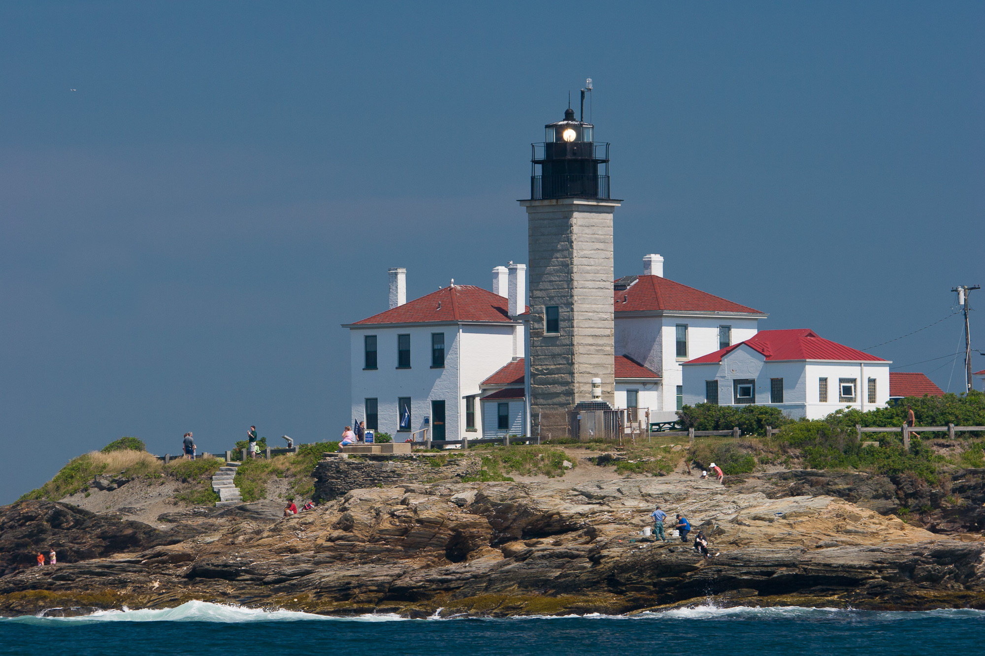
Beavertail sits at the southern end of Conanicut Island, where vessels entering Narragansett Bay pass between Jamestown, Newport, and the open Atlantic. That geography made the point useful for navigation, observation, and defense long before the modern fort was built.
During the American Revolution, the area around Beaver Tail Fort and Conanicut Battery helped guard the western approaches to Newport. In World War II, the same geography mattered again, but the tools had changed: searchlights, radar, underwater detection loops, harbor nets, plotting rooms, and long-range guns replaced earthworks and smoothbore artillery.
Fort Burnside at a glance
-
Beavertail is fortified
Revolutionary War defenses at Beavertail and Conanicut helped guard Narragansett Bay while Newport changed hands between American, British, and French forces.
-
Fort Burnside is established
The Army established Fort Burnside as part of the Harbor Defenses of Narragansett Bay. The fort was named for Ambrose E. Burnside, the Civil War general and Rhode Island governor.
-
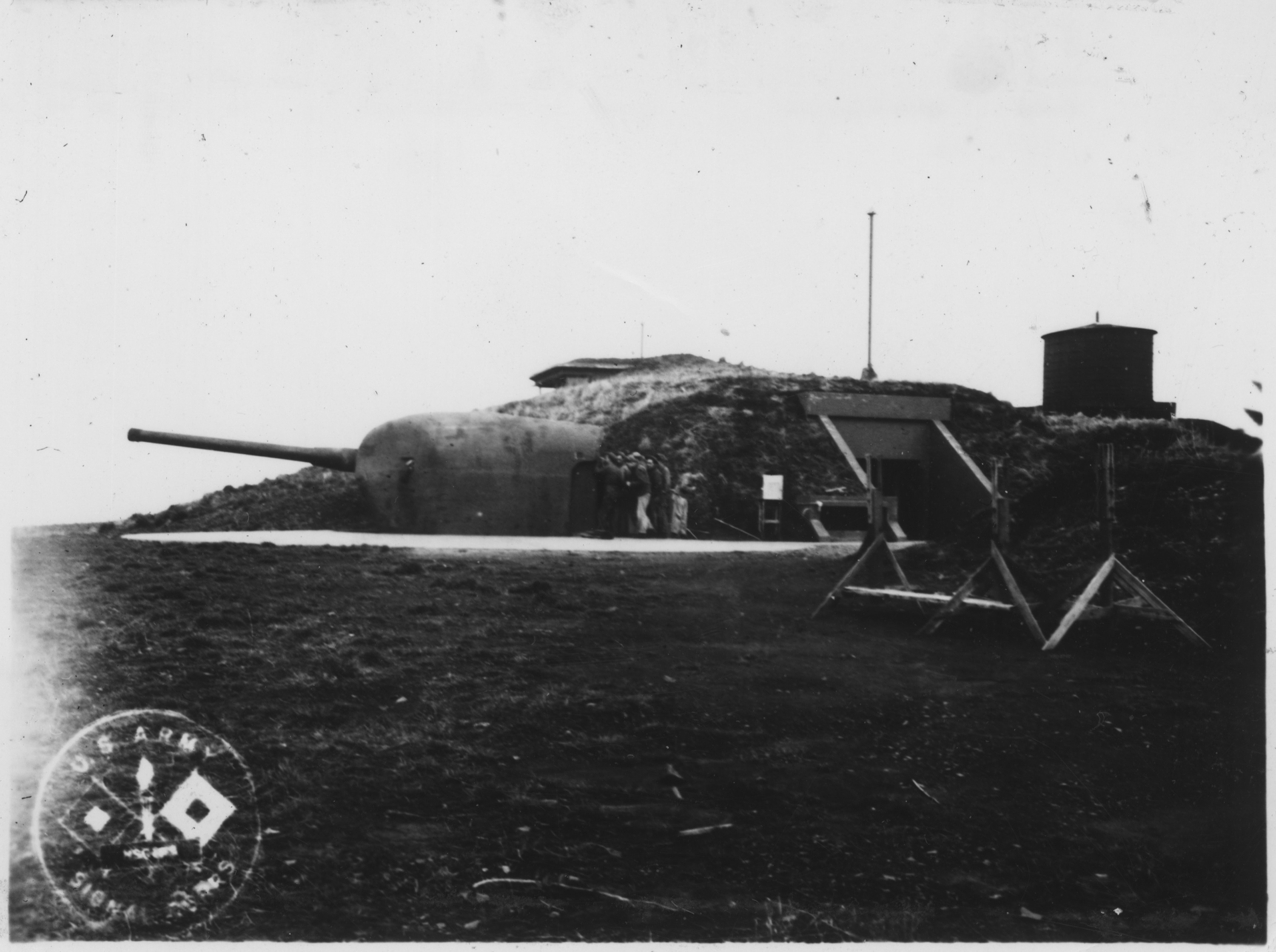
Battery 213 and Battery Whiting come online
By late 1943 the fort had a two-gun 6-inch battery, Battery Construction Number 213, plus two 3-inch guns relocated from Fort Getty as Battery Whiting.
-
The HECP watches the harbor
The Army-Navy Harbor Entrance Control Post was disguised as a seaside mansion, masking reinforced military functions behind a civilian-looking exterior.
-
The guns are scrapped
After the war, the fixed seacoast artillery system was dismantled. Fort Burnside's guns were removed as coastal defense shifted away from permanent shore batteries.
-
Naval radio station era
Part of the former fort served as NAVRADSTA Jamestown, a naval radio station connected to Naval Communications Station Newport.
-
Beavertail State Park opens
Rhode Island developed the former federal surplus land as Beavertail State Park, preserving the scenic and historic character of the point for public use.
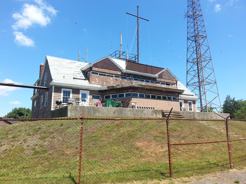
The mansion that was not a mansion
Fort Burnside's most distinctive surviving structure is the Harbor Entrance Control Post, or HECP. In wartime, this was not simply a lookout. It was a joint Army-Navy control point where information from observers, naval defenses, radar, and underwater detection systems could be coordinated as ships approached Newport and Narragansett Bay.
The disguised architecture mattered. Along the coast, many observation and fire-control structures were intentionally made low-profile or camouflaged as ordinary seaside buildings. At Beavertail, the HECP's cottage-like appearance concealed a military role tied to harbor traffic control and coastal artillery command.
Guns, nets, and underwater detection
Battery 213 mounted two 6-inch guns in shielded positions, supported by a large ammunition bunker and fire-control infrastructure. The 6-inch battery gave the fort a fast-firing weapon suited to ships moving through the approaches to the bay.
Battery Whiting added two 3-inch guns relocated from Fort Getty. The Navy also operated an indicator loop station at Fort Burnside, part of an underwater system designed to detect submarines moving through defended waters.
A larger 16-inch battery was proposed for Fort Burnside but never built. By the end of the war, aircraft, radar, guided weapons, and changing naval tactics were making the old fixed-gun system obsolete.
From military reservation to public landscape
After World War II, Fort Burnside's guns were scrapped and the military role of Beavertail changed. From about 1960 to 1974, part of the former fort was used as Naval Radio Station Jamestown, remembered locally for its tall communications tower.
Rhode Island created Beavertail State Park from federal surplus land in 1980. Today, visitors encounter the site as a place of cliffs, lighthouse history, fishing, walking, birding, and ocean views, with traces of the wartime fort still embedded in the landscape.
Plan a visitResearch Notes
This narrative is based on Rhode Island State Parks' Beavertail State Park history, published harbor-defense summaries, and Wikimedia Commons image records. Image licensing is listed on the Image Credits page.